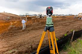
Course ID: Surveying & Geo Informatics
Department:
Semester: 4 Semesters
Year: 2 Years
About Course
The name Surveying and Geoinformatics portrays a discipline that deals with acquisition, analysis, storage, distribution, management and application of spatially-referenced data.
Nationa Diploma (ND) in Surveying and Geoinformatics (4 Semesters)
Candidates must have five credits in
- English Language,
- Mathematics and
- Physics
and any two of the following subjects:
- Additional Mathematics or Statistics
- Land Surveying
- Technical Drawing or Fine Art
- Chemistry
- Geography
- Economics or Government
- Biology or Agricultural Science
In addition to the above the student must pass UTME in English Language, Mathematics, Physics and any other subject from the above list and Post UTME examination.
- GIS technician
- Environmental technician
- CAD drafter
- GIS analyst
- Land surveyor
- Geologist
- Urban planner
- Cartographer
- Geographer
- GIS developer
